Ancient World
Crystal River Archaeological State Park
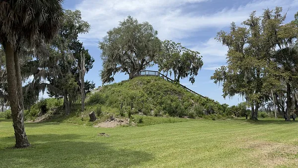
Crystal River Archaeological State Park is a 61-acre (25 ha) Florida state park in Citrus County that preserves the Crystal River Site, a pre-Columbian mound complex, together with the related Roberts Island complex downstream. The site is recorded in the Florida Master Site File, the state's inventory of historical resources, under the Smithsonian trinomial 8CI1. The park occupies a low bluff on the north bank of the Crystal River, about 1.9 miles (3 km) above the river's mouth on the Gulf of Mexico. Its mainland parcel is nearly surrounded by the separate Crystal River Preserve State Park, and the two parks are administered together. The mound complex on the park's main parcel includes a stepped platform mound about 26 feet (8 m) tall (Mound A), two smaller flat-topped platform mounds (H and K), an irregular shell mound (J), a circular earthen embankment enclosing three smaller burial mounds and a central sand mound (the Main Burial Complex, Mounds C through F), a separate burial mound (G), a long crescent-shaped ridge of discarded shell (midden, Mound B), and three limestone "stelae" (one carved with a low-relief human figure and another reportedly incised with a hand design). Radiocarbon dates analyzed by Thomas J. Pluckhahn and Victor D. Thompson show that substantive use of the site began by the second century AD and continued through the late Weeden Island period. Activity at the main complex declined by around 1050 as ceremonial life shifted downstream to Roberts Island, where mound-building and occupation continued until the complex was largely depopulated around 1233. Professional investigation began with Clarence B. Moore in 1903, whose excavations in the Main Burial Complex gave the mounds their letter designations and recovered copper panpipes and ornaments, sheets of mica, quartz crystals, and marine-shell objects that pointed to long-distance trade. Ripley P. Bullen carried out the first systematic modern investigations in the 1950s and 1960s, adding Mounds J and K to the site map and documenting two of the stelae uncovered as the property was cleared for the park in 1964. William H. Sears's 1962 paper tied the site to the Hopewell interaction sphere of the Ohio River valley and cast it as primarily a burial center, a view that shaped research for decades.
Also on this shelf
Ashdod.
As-Samu.
See also
Uncatalogued shelfText from Wikipedia; plate via Wikimedia Commons. Text CC BY-SA 4.0; plate freely licensed (see Commons). Source record. Images and catalogue data are reproduced from open-access collections.